

Copyright Trout Insights, Inc 2022
The Trout Fishing Guide to Minnesota
Trout Fishing Near Me: Minnesota Edition
Trout Fishing Near Me is a new blog series that highlights trout fishing opportunities and resources in particular regions. Our goal is to provide you with a comprehensive summary to get you started with your trout fishing journey – we want to help you spend more time on the water and less time on the road by highlighting some of the best trout fishing opportunities the state has to offer.
Table of contents
Minnesota Trout Fishing
Overall Ranking: 8 / 10
Let’s cut to the chase. Minnesota is one of the top trout fishing states in the country. A bold claim indeed. Minnesota (and Wisconsin) has an incredibly diverse trout fishing scene and unique geological factors that make it possible to seek trout 365 days of the year. You just can’t find that in other states.
– Zachary Pope, TroutRoutes
Want to skip this guide and jump to the maps? Click below.
When people think trout fishing or fly fishing in the United States, most think of Montana, Colorado and the Rocky Mountains. While it is true that some of the most productive and scenic trout fishing opportunities can be found in places like the Madison in Montana or the Frying Pan in Colorado, the reality is that Minnesota has an incredibly underrated trout fishing scene. In our opinion, there are more trout fishing opportunities in Minnesota and Wisconsin, both in terms of total water and seasonality, than the famous regions like Idaho and Montana. Let’s break down our assessment of the Minnesota trout fishing opportunities.
Regions for Fly Fishing in Minnesota


Trout Fishing in Minnesota can be broken up into four general regions, with the most popular being the Southeast which is part of the famous Driftless region. Next is the North Shore region, which includes both Lake Superior and the Tributaries. Follow these tributaries north and you’ll find the Boundary Waters Canoe Area (BWCA). After that, opportunities are sporadic – we’ll call this “everywhere else.”
The Southeast (aka the Driftless)
By far the most popular region in Minnesota for trout fishing. The Driftless region is a large 4,000 square mile region that encompasses Southeast Minnesota, Southwest Wisconsin, and Northeast Iowa. This region is very unique- many of the streams are spring fed creeks, creating highly productive trout habitats amidst rolling hills and farmlands.
In Southeast Minnesota, there are around 180 individual designated trout streams that provide over 1,300 miles of trout waters (that number varies depending on how we define the region). The Southeast is also unique in its public access laws, with hundreds of miles of designated fishing easements that provide angler access to these streams despite the land being private. A classic day in the Minnesota Driftless involves fishing a designated trout stream on an easement with rolling farmlands as a backdrop.
North Shore
The North Shore of Minnesota is one of the more visited areas in the state, particularly in the Fall during the peak season with changing leaves. Some of the most visited areas are the state parks like Gooseberry Falls State Park and Cascade State Park, both of which have notable Superior Tributary streams running through them. While a popular destination for tourist and hikers, fishing spots aren’t as crowded as you might expect – especially if you are willing to do some exploration and hiking away from the parking lots.
North Shore Trout Fishing – Migratory Species
The two primary aspects of North Shore fishing are inland and migratory. Migratory fishing is the targeting of steelhead (or other Superior-based species) that are active in the streams during the Fall or Spring runs, and this occurs below up-stream boundaries on a given river. This is typically a major waterfall but not always. For a full list of the up-stream boundaries for each stream, check out this link by the Minnesota Department of Natural Resources (MN DNR):
https://files.dnr.state.mn.us/areas/fisheries/lakesuperior/upstreampostedboundaries.pdf
Above: Boundary locations for up-stream tributaries of Lake Superior
North Shore Trout Fishing – Inland Trout
Above the boundaries, the seasons are different and the targeted species is typically exclusively Brook Trout with minimal Rainbow and Brown trout opportunity. This area is notably different as you head further North – you’ll find increased elevation and interesting topographies as you travel closer to the Canadian border and Boundary Waters Canoe Area (BWCA).
Boundary Waters Canoe Area (BWCA) Trout Fishing
The boundary waters canoe area is a vast protected area in the northern part of Minnesota. This unique region has strict development limitations making it an incredibly vast and wild place. This region includes both streams and lakes containing trout, but species in this area are almost exclusively brook trout and lake trout. Again, this region involves different regulations, seasons and tactics.
Everywhere Else
Technically, there are designated trout streams in various places in Minnesota outside the regions noted above. These streams typically get much less traffic and are arguably not as reliable or productive for trout. For example, the cabin-popular town of Brainerd in northern Minnesota surprisingly has a few designated trout streams within 30 miles, including Whitley’s Creek, Stoney’s Creek and Sand Creek. However, few would argue these are top destinations. The spotty stream quality and massive mosquito population can make these streams hard to love for trout anglers. You’re better off in the thousand or so nearby lakes searching for bass and pike.
Seasons – Best Time to Go


One of the things I love most about trout fishing in Minnesota is the diversity and seasonality. I’ve lived in both Montana and Minnesota during my fly fishing career and can say this with certainty: when its on in Montana, its on. But its not always on. For example, there is a two week period each year in Montana where you can throw giant size 6 dry flies and get aggressive takes on every cast – this is called the famous Salmon Fly Hatch. But there is also a 2-3 month period where fishing is generally completely shut down during run-off, outside of some rare spring fed examples and possibly some tailwaters. In my experience, the fishing seasons out West are actually fairly limited compared to Minnesota.
In Minnesota and Wisconsin, 95% of the trout fishing opportunities are spring fed creeks where the temperature of the water remains consistent throughout the year. In addition, both states have lengthy regulation season for catch and release (C&R). Combined, you can literally catch a trout 365 days of the year if you have the time and patience in Minnesota. This just isn’t possible in places like Montana and Colorado.
Our Trout Fishing Seasons Summary for Minnesota
With that being said, the best time to go trout fishing in Minnesota depends on region and target species. TroutRoutes put together a recommended seasons chart, broken down by region and color coded on level of quality for that region by the month below. For most of the inland trout anglers reading this article, we recommend Spring and early Fall to be peak season, with sporadic opportunities throughout the summer limited only by heat and mosquitoes.

Minnesota Trout Fishing Regulations
The Seasons and Regulations for trout in Minnesota are relatively complex, largely driven by differences by region and species. We have tried to simplify this by putting together the following regulations chart, broken down by region and month. We also strongly encourage you to review Minnesota Department of Natural Resources guidance (link below).
https://www.dnr.state.mn.us/fishing/regs.html?section=definitions&topic=inland
Seasons and Closures

Special Discussion on Inland Trout Seasons
Many of our readers are targeting inland trout primarily in the Southeast. For this reason, its worth elaborating on the seasons that are available for inland trout fishing. If you check out the season chart for just inland trout below, you’ll notice there is not a single time in the year where there are no options available for trout fishing. We’ll break up each season to be more clear on what’s available.

January – April 15th: Early C&R Season

This is the early inland trout season in Minnesota, and is catch and release only. During this time, you can trout fish in the following areas: select State Parks, select Townships and the 8-county region in the Southeast, shown to the right. This season is catch and release only for all areas. The specific state parks and city limits are listed below.
State Parks: Forestville SP, Whitewater SP, Beaver Creek Valley SP.
City Limits: Chatfield, Lanesboro, Preston, Rushford, and Spring Valley.
April 15th – September 15th (or 9/30) – General Open Season
General trout season when harvest is allowed, minimal restrictions. Applies to Southeast and outside the Southeast. You generally can fish for trout pretty much anywhere during this time (North Shore and BWCA is a different story).
September 15 – October 15: Mid Fall Season
This is a transitory 4 week timeframe where fall limitations start to kick in. Catch and release in the Southeast continues through October 15th, but outside the Southeast the harvest season ends October 1st.
October 15th – December 31st – Late Fall Season:
This is generally when inland trout fishing tapers off, but you still have some options. During this season you are allowed to trout fish in the state parks and city limits mentioned above, catch and release only. This is when you’ll find the least amount of people if you’re willing to make the trek to the few open areas to fishing. It can be a rewarding time of the year.
Gear Restrictions
In Minnesota, there are generally two different classes of regulations related to gear: bait-allowed and artifical-only. It is very important to read and understand the MN DNR regulations each season as the gear restrictions can and do change seasonally. For example, the link below shows what gear restrictions (and size limits) apply to each trout stream in the Southeast region.
North Shore Gear Restrictions: No treble hooks allowed on Lake Superior Tributaries
https://www.dnr.state.mn.us/regulations/fishing/trout_se.html
Stream Access Laws of Minnesota
Disclaimer: We are not lawyers, and this is not legal advice. When in doubt, always respect and abide by private and posted lands. By reading this, you acknowledge we are providing our own understanding and do not guarantee the legal accuracy of this information (aka don’t sue us).
Great, now that we got that out of the way. Here is the summary on public access to trout streams in Minnesota, an incredibly important issue.
Summary: The riverbed of any river or stream “that is capable of recreation” can be publicly accessed and is open to the public, provided you stay in the water at all times. This is often referred to as “keep it wet.”
In general, if a stream or river is considered “capable of recreation” by anything bigger than a personal watercraft (think a kayak), then it is considered under the access laws which means the state maintains access the land under the stream, and the public may access that water provided they stay in the water with their feet wet at all times. This means that anglers can legally access the stream, provided they remain in the stream. How does one get to the stream? This can be tricky, but generally speaking any public road that crosses the stream is also public property, and many anglers use public road bridge crossing as entry points to many trout streams.
Some issues and considerations:
- Even as I write and research this article, there is still some open discussion on what defines a “navigable” stream or river. I often hear the term watercraft as being a personal kayak. But I am not certain of that and even if so, it is still relatively subjective which streams can be floated using a kayak. I can see this being debated in court.
- Private access points from public bridges can be hit and miss. I often see these points with private lands posted and barb wires around or near the river. In some cases, the public stream may have a barb wire fence crossing the stream, making public access within the stream nearly impossible, despite being legal.
- My personal advice is to use your head and play it safe. There is plenty of easement water where conflict is nearly non-existent and if you find yourself pushing the limits on your understanding of the law with a feisty private land-owner, the chances of a good outcome are low. Who wants to trout fish looking over your shoulder knowing a conflict with a land-owner is imminent? Further, these confrontations do very limit to improve the delicate and crucial relationship between the angling community and private land-owners on our trout streams.
https://www.dnr.state.mn.us/waters/watermgmt_section/pwpermits/waterlaws.html
Special Discussion on Easements

Despite the favorable navigable access laws in Minnesota and Wisconsin, anglers have a better option. Both states have an incredible resource that I once took for granted having not experienced other parts of the country – designated fishing easements. The concept of fishing easements is an incredible resource that the DNR of both states have invested heavily in, in collaboration with Trout Unlimited, to provide public access to trout streams on private land. This unique program offers anglers friendly, designated areas of fishing access to incredible fisheries that would be otherwise difficult or impossible to access. A few key things to keep in mind:
- Public access to fishing easements is for fishing only. You are not allowed access for other uses such as hunting, cross country skiing, etc.
- Public access is limited to the angler and for the act of fishing. You are not allowed to bring dogs, camp, etc.
- Fishing easements are on private land. RESPECT THE PRIVATE PROPERTY. These easements are an incredible resource to anglers and depend on particpating private landowners. It is critical that we anglers respect these easements by not litering, trespessing beyond the easement, parking where we shouldn’t, etc.
- To the best of my knowledge, access to fishing easements is not restricted to time of day or season. You can night fish on an easement. I believe you can also access an easement even when the season is closed for scouting, though this is a bit gray.
- For more information of Minnesota DNR Easement Program, start here.
How to find fishing easements?
There are generally two primary options in locating and navigating trout stream easements in Minnesota; the DNR PDF maps and TroutRoutes. We’ll discuss both below.


MN DNR PDF Maps
One of my favorite (free) resources is the Minnesota DNR PDF Maps. We will discuss these more in later sections. But for the particular use of finding trout fishing easements, these can be fun maps to study. These maps are provided in 15 different rectangular regions, mostly in the Southeast. Each PDF provides designated trout streams by name, variety of public land, some road names, and fishing easements (gray). The best part, these are free and managed by the DNR so they are very reliable.
TroutRoutes Maps

If you are looking for the next step up in trout stream maps, TroutRoutes is the way to go, but it’s not free. TroutRoutes provides the same easement and public land data as the MN DNR Maps, but with TroutRoutes you get many other features such as GPS, real-time stream conditions, and tons of other layers like camping, parking and bridge locations, trail access, and more.
One main advantage of TroutRoutes from an easement perspective is that the maps are nationwide. We spend an incredible amount of time making the maps cross state lines. So for Minnesota and Wisconsin trout stream easements, there is no second resource you need to find with the WI DNR. The screenshot below of our Web Maps demonstrate the power of the Access Mode, where all trout stream easements are shown for every trout stream in Minnesota and Wisconsin. This same benefit applies to all 23 states we currently support. So if you are looking to cross state lines into the Wisconsin Driftless, having a tool like TroutRoutes might be worth the investment.

Fly Shops and Guides of Minnesota
Minnesota has a stable and growing community of professionals serving the local trout angling industry. Below is a summary of these resources to help you connect. Bookmark this page if you’d like, its not going anywhere.
Fly Shops
Minnesota is home to eight fly shops, not including major retailers that may occasionally carry fly fishing gear (think Dick’s Sporting Goods or Scheels).
Name | Region | Website | Address | Phone |
Fly Box & Co. | North Shore | 14 1st Avenue West, Grand Marais, MN 55604 | (218) 370-9659 | |
Great Lakes Fly Fishing | North Shore | 4426 Regent Street, Duluth, MN 55804, United States | (218) 740-3040 | |
Bob Mitchell’s Fly Shop | Metro | 550 Vandalia Street #119, Saint Paul, MN 55114 | (651) 770-5854 | |
Orvis | Metro | 5001 Excelsior Boulevard, St. Louis Park, MN 55416 | (612) 293-1369 | |
The Fly Angler | Metro | 10091 Central Avenue Northeast, Blaine, MN 55434 | (763) 572-0717 | |
Mend Provisions | Metro | 2719 East 42nd Street, Minneapolis, MN 55406 | (612) 724-4272 | |
Dirftless Fly Fishing Company | Southeast | 208 Saint Paul Street Southwest, Preston, MN 55965 | (507) 327-4276 | |
Root River Rod Co. | Southeast | 116 Parkway Avenue North, Lanesboro, MN 55949 | (507) 467-2101 |
Fly Fishing Guides of Minnesota
For guides in Minnesota, we wanted to filter for those guides that focus on fly fishing, which is essentially every guide we know of. Then we wanted to focus on only those that cover inland trout waters as opposed to exclusively migratory fish like steelhead – while we eventually will cover the migratory use case at TroutRoutes, we are currently focused exclusively on inland trout. With that, here is a list of the recommended fly fishing guides of Minnesota based on the region.
Name | Region | Area / Focus | Website |
Carl Haensel | North Shore | North Shore Trout and Steelhead | |
Arrowhead Guide Service | North Shore | North Shore Trout and Steelhead | |
North Shore Guide Service | North Shore | North Shore Trout and Steelhead | |
PVS Angling | North Shore | Wading trout trips | |
Driftless Fly Fishing Company | Southeast | Wading trout trips | |
Trout Buddy | Southeast | Wading trout trips | |
On the Fly Guide Service | Southeast | Wading trout trips | |
Root River Rod Co. | Southeast | Wading and Floating trips | |
West Fork Guides (Bryan Trapper Voldahl) | Southeast | Wading trout trips | |
Wildwood Floats | Central | Small-mouth bass floats | |
Head Waters Fly Fishing | Central | Central Minnesota Trout, Musky and Bass | |
Mahigan Outdoors | Metro | Vermillion Brown trips | |
Bob Mitchell’s Fly Shop | Metro | Multiple guides. Metro-based fly fishing for trout, bass and muksy. |
Books and Other Resources
There are a ton of resources out there to help you on your trout fishing journey, particularly in Minnesota. To start, try one of the many high-quality fly shops listed above near you. Stop in, shop around, buy some stuff, and ask questions. Secondly, if you are new to the sport or an area, hiring a guide is an incredibly valuable investment, particularly for fly fishing. If you plan to fly fish for more than a year, you’ll want to learn the basics without spending years learning on your own. Hire a guide. Use the list above as a good starting point.
Beyond that, there are many resources for you to dive into, ranging from books to public government resources to professional map offerings like TroutRoutes. We’ll break these down below.
Books for Trout Fishing in Minnesota
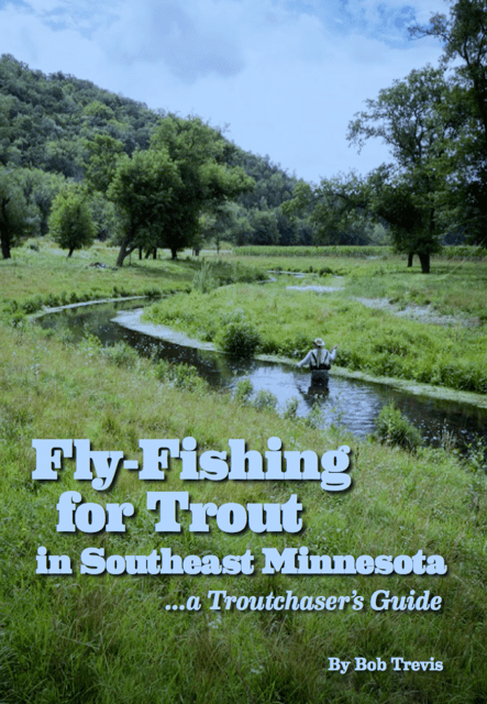
Fly-fishing for Trout in Southeastern Minnesota
Bob Trevis, 2016
Arguably one of the best trout fishing books for Southeastern Minnesota. Bob Trevis brings over 30 years of trout fishing experience into this detailed guide book. Included are discussions on particular streams, tips and tactics, references to other resources and more.
Where to buy: Very limited supply! Check with local fly shops and pick this up if you find it.

Trout Streams of Wisconsin and Minnesota
Jim Humphrey & Bill Shogren, 2001
A classic must-have for anglers in the Driftless, this book provides great detail highlighting top streams in the Southeast Minnesota and Wisconsin.
Where to buy: Most local fly shops and Amazon

Trout Fishing in Southeast Minnesota
John Van Vliet, 2019
Another classic for anglers in the Driftless, this book provides great detail highlighting top streams in the Southeast Minnesota and Wisconsin.
Where to buy: local fly shops in Minnesota

Improved Trout Waters of Minnesota and Iowa
Dave Vetrano and Todd Hansen, 2011
This is a super helpful and unique mapping book that highlights trout habitat improvement projects over the years on streams in Minnesota and Iowa, primarily in the Driftless regions of Southeast Minnesota and Northeast Iowa.
Where to buy: local fly shops and amazon

Fly Fisher’s Guide to Minnesota, 2nd Edition
Carl Haensel, 2021
This new edition of the original Fly Fisher’s Guide to Minnesota is a must-have for any Minnesota trout or fly angler. This series offers both comprehensive tips and descriptions of areas, but also includes colored maps and gps coordinates as well. For those that target more than just trout, this series also covers fly fishing opportunities for small-mouth bass and pike as well.
Where to buy: preorder at the link below
Link: https://namebini.square.site/product/flyfisher-s-guide-to-minnesota-pre-order/11?cs=true&cst=custom

Fly Fisher’s Guide to Minnesota, 1st Edition
Mickey Johnson, 2012
This original Fly Fisher’s Guide to Minnesota is a must-have for any Minnesota trout or fly angler. This series offers both comprehensive tips and descriptions of areas, but also includes colored maps and gps coordinates as well. For those that target more than just trout, this series also covers fly fishing opportunities for small-mouth bass and pike as well.
Where to buy: mostly available on Amazon
Link: https://www.amazon.com/Flyfishers-Guide-Minnesota-Mickey-Johnson-ebook/dp/B005FH2JNE/ref=sr_1_4?crid=32HBBNZ36VBVE&keywords=fly+fishing+minnesota&qid=1641844061&sprefix=fly+fishing+minnesota%2Caps%2C83&sr=8-4
USGS Stream Gages

The United States Geological Survey (USGS) maintains thousands of in-stream flow gages that provide real-time data from streams of interest to trout anglers. Data typically comes in the form of flow height, flow discharge and sometimes temperature. If you know where to look and have the time, this can be a useful resource in researching timing of when to head out on your next trip. For example, in the Spring during snow melt or during the summer after major rainstorms, the discharge of a stream can fluctuate dramatically and have a huge impact on fishing. Some anglers target these times for darker water streamer fishing, while others avoid it for the more stable dry fly fishing tactics. Regardless, it’s critical to know stream levels and flow. Below is a screen shot of the USGS output of a trout stream in Southeast Minnesota.

The downside of the USGS interface is its quite difficult to navigate and interact with. I personally end up typing in a specific gage location or ID to find the charts, and the output is a static image. For this reason we integrated the same functionality into TroutRoutes where you can view the gages within the map, tap the gage for current conditions and view charts that are interactive. One downside of the TroutRoutes charts is we currently don’t have averages displayed, which is a key piece of insight that we’ll be adding in early 2022. The screenshot to the left shows the same chart as the USGS chart shown above, to give you an example.
Fly Fishing Women of Minnesota

For the female anglers out there, the Fly Fishing Women of Minnesota is a tremendous resource and group for education, fellowship and networking. They are active in every Minnesota Fly Fishing event and have several outings and chapter meetings each quarter. There website has several useful links and resources as well.
Maps

Luckily for the Minnesota trout angler, there is a variety of mapping resources available. The good folks at Minnesota’s Department of Natural Resources have done a fantastic job managing and administering the cold water resources for decades. This includes providing PDF maps that provide locations of designated trout streams throughout the state. There are additional resources for places like the North Shore that provide high-level maps of the trout streams, species present, and key boundaries like the inland boundaries of the north shore that separate key migratory regulations.
If you’re looking for something more when it comes to maps, we of course have to recommend TroutRoutes. We’ll provide a breakdown and links to these resources as well as a comparison to help you navigate the options.
Minnesota Department of Natural Resources (DNR)
There are several resources the DNR provides. The first is an interactive website that shows trout streams, regulations, and hyperlinks to more information. The second is the popular trout stream PDF maps provided by region in 18 different regions. Most of us find these useful primarily for its marking of fishing easements and regulations, which as mentioned above provide unique fishing access to trout streams on private lands. Lastly, we should mention the useful north shore fishing guide that highlights species, boundaries, and some public land. Lastly, there are area specific maps available as well that provide more insights on things like hiking trails and camping opportunities, particularly for state parks and forests. For example, the Whitewater State Park has a detailed map shown below that highlights the hiking trails and and other amenities.
- MN DNR Interactive Trout Stream Maps: https://www.dnr.state.mn.us/fishing/trout/map.html
- MN DNR PDF Trout Stream Maps: https://www.dnr.state.mn.us/fishing/trout_streams/south_mn_maps.html
- MN DNR North Shore Fishing Guide: https://files.dnr.state.mn.us/maps/trout_streams/ns_fishing_guide01.pdf
- State Park Maps (White Water State Park example): https://www.dnr.state.mn.us/state_parks/park.html?id=spk00280#maps


TroutRoutes

Full Disclosure: Yes, we work here 🙂
Our mission at TroutRoutes is to provide a comprehensive mapping platform that has all the information you could need integrated into one platform. We do this across state lines, providing one system for over 23 states. So while local DNR maps can be incredibly useful (and almost always free), our goal is to make that information (and a lot more) available for every state in one useful tool.
Our system is an interactive map that has a variety of features, many of which are not available on other resources mentioned before. TroutRoutes shows your GPS location, provides you directions to anywhere in the map, is available offline, and helps you identify and navigate private and public land boundaries. We also have new layers for things like camping, boat ramps, parking, trail heads, and many more. The caveat: its not free, but there is a free 7-day trial to check it out for yourself. The table below shows a summary of the main tradeoffs for the various mapping resources available for trout fishing in Minnesota.


Below is a comparison chart of the various resources available from a mapping perspective given the desired features and use cases that most of us anglers care about.

Want to try TroutRoutes Pro? Get started with a free 7-day trial at the link below!
Conclusion
We hope we’ve made the case that Minnesota is one of the most underrated and diverse trout fishing states in the country. If you are a Minnesota trout angler or have the opportunity to make the trip, we highly encourage you to check out some of the many resources outlined in this article. If you’d like to add content or request a change, always feel free to reach me at zpope@troutinsights.com.
Tight lines,
Zach
—
Contributors: This article was written by Zachary Pope in January of 2022. Zachary is the CEO & Founder of TroutRoutes. Additional contributors include Carl Haensel of Namebini Guide Services as well as Minnesota Trout Unlimited.


Front 20 Outfitters is a fly shop in Perham, MN. After I return from Esquel, Argentina, where I am trout fishing, I’ll tell him about T. R. and give him your web address. He has a web site also.
This is an outstanding reference ‼️ I’ve been with you guys from the early days Your growth and “spot on” awareness of what we anglers are really searching for continues to impress I’ll be in Wisconsin and Montana this summer and am really looking forward to future blog reports